
Coastal section: Beachy Head area
Sussex RIGS number: TV59/10d
Forms part of the Seaford to Beachy Head SSSI designated for its geological and biodiversity value (Site Code 1000182)
The LGS site is located in Unit 1 of the SSSI.
Forms part of the Beachy Head to Seaford Head Geological Conservation Review (GCR) Site
Block: Coastal Geomorphology of England (Site Code 1850)
Includes the Beachy Head Cave (GCR) Site
Block: Caves (Site Code 558)
The Beachy Head area is within the South Downs National Park
Grid Reference: TV563955 to TV593954
Owner:
Eastbourne Borough Council
Site access:
This eastern part of this stretch of coast is accessible from the east at Cow Gap which is reached by public footpath from Beachy Head Countryside Centre where there is a large pay and display car park.
The western part of the site is accessible from the west at Birling Gap where the National Trust provides car parking and a cafe.
Great care should be taken regarding potential cliff falls and tide conditions. There are no intermediate access points between Birling Gap and Cow Gap and the foreshore is partially blocked by a large debris fan near the Beachy Head lighthouse. The traverse is long and should only be attempted on a falling tide and 6 hours should be allowed. If walking from Cow Gap to Birling Gap, it should be ascertained beforehand that the Birling Gap steps are in place, as winter storms occasionally wash them away.
The cliff top between Belle Tout lighthouse and Beachy Head is accessible by the South Downs Way. The downland here is open access land.
Summary Description:
09/08/2011,10/08/2011 and 22/09/2011
(from East Sussex RIGS Survey 2011)
Interest Feature(s)
Bedrock:
3 km of spectacular undefended chalk cliffs up to 160 m in height (at Beachy Head). Dip to west exposes successive formations from the base of the Chalk to the middle of the Seaford Chalk. The extensive wavecut platform exposes formations from Zig Zag Chalk to basal Seaford Chalk but the West Melbury Marly Chalk is covered by sand at Falling Sands.
Stratigraphy: West Melbury Marly Chalk and Zig Zag Chalk Formations, Grey Chalk Subgroup, Upper Cretaceous (Cenomanian) in age.
Holywell Chalk, New Pit Chalk, Lewes Chalk and Seaford Chalk Formations, White Chalk Subgroup, Upper Cretaceous (Turonian and Santonian) in age.
This section includes the classic Cenomanian-Turonian boundary. This is the finest exposure for Cenomanian (Lower Chalk) and Turonian (Middle and Upper Chalk) available. The finest boundary section between New Pit and Lewes Nodular Chalk is near the lighthouse.
Sedimentology: predominantly chalk, deposited in a relatively deep marine environment. The Grey Chalk includes thick marl seams, notably the Plenus Marl. Marls occur intermittently in the White Chalk and flint bands are common above the New Pit Chalk.
Sedimentary structures: There are griotte (interlaced marls) seams beneath the Glynde Marl (top New Pit Chalk). There are nodular chalks in the Holywell and Lewes Chalk formations. The New Pit and Seaford Chalks are more uniform and white.
Structural geology: gentle dip to west towards axis of the Birling Gap syncline, major joint planes
Palaeontology: Many fossils have been found including brachiopods, belemnites, bivalves, ammonites, foraminifera, sponges, crinoids and echinoids. There are also abundant trace fossils such as Zoophycos, Bathichnus paramoudrae.
Geomorphology:
The entire section is a classic site for coastal geomorphology associated with cliff recession. The cliffs are actively eroding with major landslide scars and debris, notably the large debris fan from the January 1999 landslide. Collapse of a major block destroyed the landmark known as Devil's Chimney in April 2001. The largest cave (350 m) known to be formed by phreatic processes in chalk in Britain is present in the cliffs about 400 m west of the lighthouse.
Site map - Aerial photography 2005 - Survey visits 09/08 and 10/08/2011, 22/09/2011
RIGS Designation Criteria:
Scientific Details and Site Description
This length of chalk cliffs, and wave cut platform, includes the section from east of Belle Tout, to and including, Falling Sands of Beachy Head.
Stratigraphy: this section of the Chalk cliffs starts from the base of the Middle Chalk resting on the Plenus Marls and then spans the Upper Chalk up to and including the Seven Sisters Flint Band. This includes the Cenomanian and the Turonian and the junction between them. This classic CT boundary is found between Gun Gardens east to Holywell. Near the Lighthouse is the finest boundary section between New Pit and Lewes Nodular chalk.
Sedimentology: the sediments consist predominantly of chalk, with flint bands and some marl seams. In some beds there are intraclast conglomerates associated with red iron-stained sponge beds, or nodular layers. There are chalk layers with detrital shell fragments.
Sedimentary structures: there are griotte (interlaced marls) seams beneath the Glynde Marl. There are several nodular chalks forming rhythmic layers in the Lewes Chalk. The Seaford Chalk is more uniform and white.
Palaeontology: many fossils have been found including brachiopods, belemnites, bivalves, ammonites, foraminifera, sponges, crinoids and echinoids. There are also abundant trace fossils such as Zoophycos, Bathichnus paramoudrae.
Geomorphology: one of the largest caves known to be formed by phreatic processes in England is present in the cliffs of Beachy Head. The entrance is about 14 ft above the beach and ¼ mile west of the lighthouse. The tube is between 3 to 4 ft wide and only 2ft high and in the order of ¼ mile long.
Archaeology and Natural History: the cliff tops have a number of early earthworks and tumuli and the cliff top flora and fauna is of great interest and importance.
Educational value: This length of cliffs with the wavecut platform is of enormous value for scientific studies of Chalk stratigraphy, environmental conditions, sedimentation and for tectonic and palaeontological studies. This is the finest exposure for Cenomanian (Lower Chalk) and Turonian (Middle and Upper Chalk) available and nowhere else is it possible to walk through the whole section. It is the parastratotype for the world reference CT boundary section in Pueblo in New Mexico. At 165m the cliffs at Beachy Head are the highest in England.
This area is of interest to geologists, palaeontologists and is suitable for large groups. The cliff top fauna and flora are of interest to natural historians and botanists and the whole area is used for recreation. The South Downs Way commences from behind Beachy head. There are also archaeological remains on the cliff tops. The cave is of enormous geomorphological importance.
GCR Site Account:
Beachy Head to Seaford Head
Introduction
Block: Coastal Geomorphology of England (Site Code 1850)
The Chalk of the South Downs reaches the sea between Brighton and Eastbourne in a series of cliffs that become generally higher towards the east and culminate in the 150 m-high cliffs of Beachy Head. This site comprises a cliff-beach-platform system developed on the Chalk, includes the classic world-renowned cliffs of Beachy Head and the Seven Sisters, and cuts across the mouth of the Cuckmere Valley. The cliffs reach a maximum height of 156 m at Beachy Head (TV 588 956) and vary between 14 m and 79 m in height along the Seven Sisters. Retreat of the cliffs has been estimated at 0.42 m a-1, reaching a maximum of 0.91 m a-1 at Birling Gap (May, 1971a). A narrow fringing beach of chalk and flint rests upon the cliff-platform junction, except where major falls, especially at Beachy Head, extend below low-tide level (Figure 4.26). Debris ramparts from cliff-falls are common at Beachy Head. The coastline plan is controlled primarily by dominant and prevailing wave energy from the south-west, with Seaford Head and Beachy Head acting as more resistant points between which a predominantly wave-energy controlled shoreline has developed. Structural variations seem to have had little effect upon the overall coastal plan, the cliff materials being sufficiently rapidly eroded to ensure control by wave action. However, in detail the cliffs are controlled by a rectilinear jointing pattern. The beach is one of six major SW-facing beaches in southern England, all of which differ significantly in their geological characteristics. Most of the site faces south-west and is exposed to Atlantic waves. The fetch from the south-west is similar to that which affects all the major beaches in the English Channel. The cliff and beach of Seven Sisters in particular is unusual in having a very strong similarity in its alignment to such beaches as Chesil Beach and Dungeness. Of the beaches, Seven Sisters beach is the most rapidly and consistently fed by flint from cliff-falls. The most directly comparable cliffs also comprise Upper Chalk along the Normandy coast, but they lack the same aspect and degree of exposure.
The Beachy Head LGS site represents sub-unit 2 of the GCR:
The high complex cliffs of Beachy Head (TV595955 to TV579953).
The full site account is on the JNCC website.
Published in the Geological Conservation Review
Volume 28: Coastal geomorphology of Great Britain (2003)
Chapter 4: Soft-rock cliffs
GCR Site Account - Beachy Head Cave
Block: Caves (Site Code 558)
Published in the Geological Conservation Review
Volume 12: Karst and Caves of great Britain (1997)
East Sussex Local Geological Sites - Coastal Section Beachy Head - west
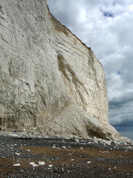
Cliffs about 60 m high at Belle Tout exposing Seaford Chalk. Shows landslip scar with fallen slab at base. Seven Sisters flint band is high in the cliff cutting across the top of the slip debris.
Photograph taken: 09/08/2011
Grid ref TV56539543
Direction ESE
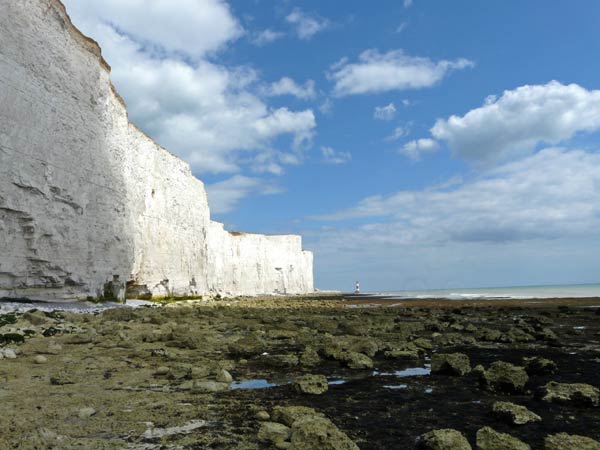
Cliffs, sea caves and wavecut platform east of Belle Tout. Dip is to the left (west) and beneath the Seaford Chalk successively older beds (upper Lewes Chalk) are exposed towards the lighthouse.
Photograph taken: 09/08/2011
Grid ref TV56359548
Direction ESE
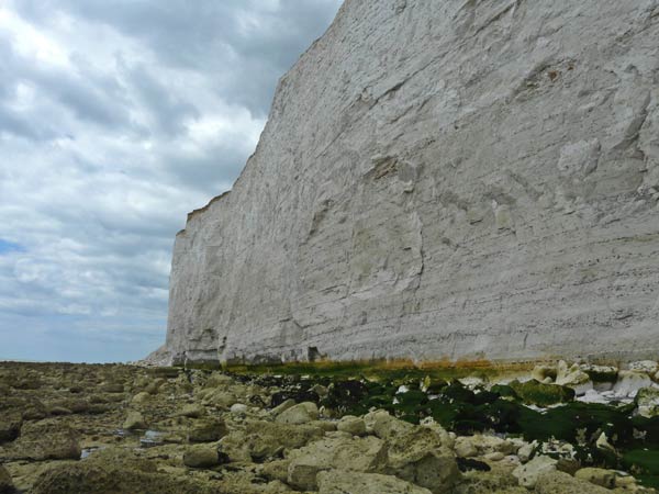
Cliffs 50 to 60 m high east of Belle Tout showing gentle dip to the left (west) and exposing Seaford Chalk with numerous close-spaced flint bands (Seven Sisters band is high in the cliff). The lowest beds include marl seams and are close to the top of the underlying Lewes Chalk.
Photograph taken: 09/08/2011
Grid ref TV56849538
Direction west
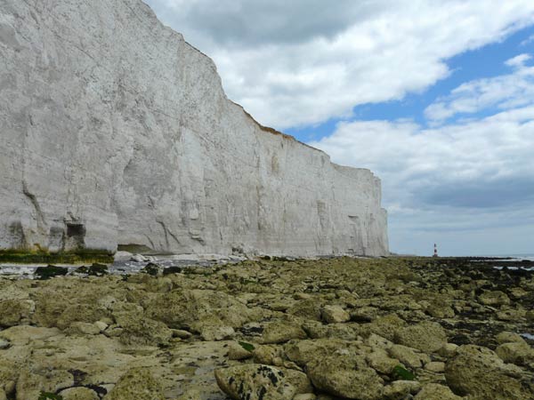
Cliffs and wavecut platform east of Belle Tout. Dip is to the left (west) and beneath the Seaford Chalk successively older beds (upper Lewes Chalk) are exposed towards the Beachy Head lighthouse.
Photograph taken: 09/08/2011
Grid ref TV56359548
Direction east
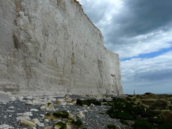
Cliffs 60 to 90 m high between Hod Combe and Shooters’ Bottom. Mainly Seaford Chalk with upper Lewes Chalk (greyish and nodular) at base. Stratigraphy defined by numerous flint layers and also by marls in the lower section. Gentle dip to left (west).
Photograph taken: 09/08/2011
Grid ref TV56979539
Direction ESE
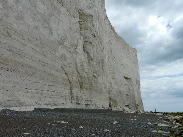
Cliffs about 90 m high and shingle beach below Shooters’ Bottom. Lewes Chalk at base and Seaford Chalk above. Stratigraphy defined by numerous flint layers and also by marls in the lower part. Dip to left (west).
Photograph taken: 09/08/2011
Grid ref TV57059539
Direction ESE
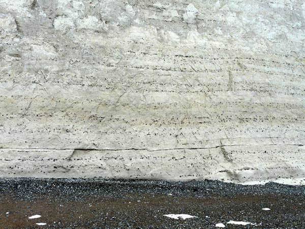
Close-up of Lewes Chalk at base of cliff showing close-spaced flint layers, mostly with scattered flints but also a tabular layer.
Photograph taken: 09/08/2011
Grid ref TV57059539
Direction north
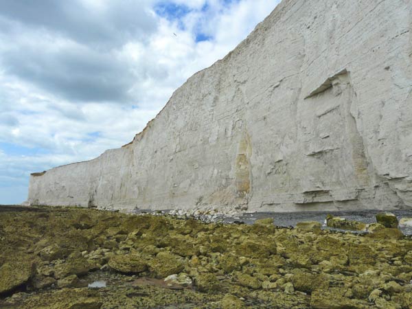
Cliffs west of Shooter's Bottom up to 75 m high exposing Lewes Chalk at base and Seaford Chalk above. Gentle dip to west carries top of Lewes Chalk below the base of the cliffs in the middle distance.
Photograph taken: 09/08/2011
Grid ref TV57259528
Direction WNW
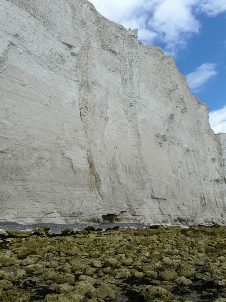
Cliffs immediately west of Shooters Bottom up to 90 m high exposing Seaford Chalk in the upper part of the cliff and Lewes Chalk beneath. The Seven Sisters flint band lies in the upper half of the cliff here.
Photograph taken: 09/08/2011
Grid ref TV57259528
Direction NE
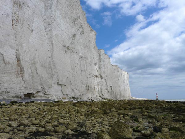
Cliffs east of Shooters’ Bottom rising from 90 m to 130 m at the lighthouse and exposing successively older beds in the Lewes Chalk at beach level.
Photograph taken: 09/08/2011
Grid ref TV57259528
Direction ESE
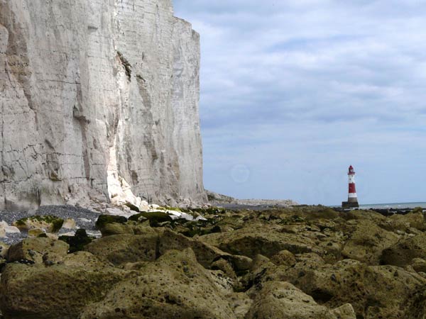
Cliffs and wavecut platform east of Shooters’ Bottom. Cliffs cut in Lewes Chalk with overlying Seaford Chalk. Note tongue of debris from 1999 landslide extending towards the lighthouse. Photo taken with zoom lens.
Photograph taken: 09/08/2011
Grid ref TV57229533
Direction ESE
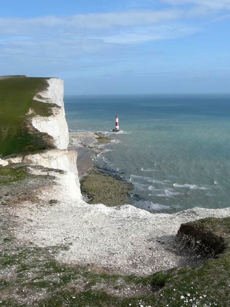
Cliffs, foreshore and lighthouse from the crest of the down above Shooters’ Bottom. The cliff tops expose Seaford Chalk.
Photograph taken: 22/09/2011
Grid ref TV57449532
Direction ESE
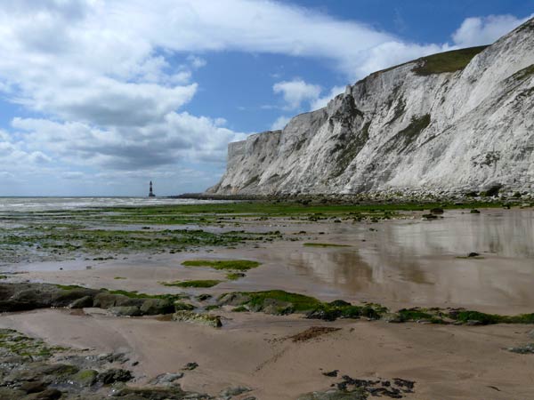
Cliffs and foreshore west of Falling Sands to lighthouse. The gentle dip to the left (west) in these cliffs exposes first Zig Zag Chalk, then Holywell Chalk and then New Pit Chalk beds at beach level with overlying Lewes and Seaford Chalks in the cliffs.
Photograph taken: 10/08/2011
Grid ref TV59399545
Direction WSW
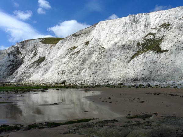
Cliffs up to 120 m high behind Falling Sands. The gentle dip to the left (west) in these cliffs exposes first West Melbury Marly Chalk, then Zig Zag Chalk and then Holywell Chalk beds at beach level with overlying New Pit Chalk culminating in Lewes Chalk at the top of the cliffs.
Photograph taken: 10/08/2011
Grid ref TV59399545
Direction NW
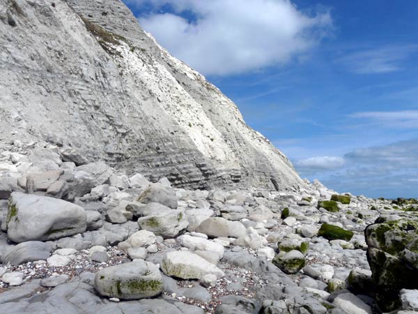
West Melbury Marly Chalk exposed at beach level behind Falling Sands showing interbedded chalk and marls with dip to left (west).
Photograph taken: 10/08/2011
Grid ref TV59299551
Direction ENE
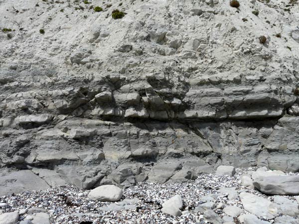
Detail of West Melbury Marly Chalk at base of cliff showing about 2 m of alternating beds of marl and chalk.
Photograph taken: 10/08/2011
Grid ref TV59339553
Direction north
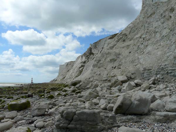
View west along base of cliffs towards lighthouse. Gentle dip to west exposes West Melbury Marly Chalk at base of cliff on right, then Zig Zag Chalk at centre and Holywell Chalk beyond.
Photograph taken: 10/08/2011
Grid ref TV59339553
Direction WSW
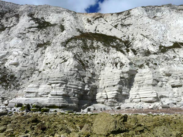
Cliffs up to120 m high exposing Zig Zag Chalk with interbedded marls in lower cliff, dipping gently to left (west). Overlain by Holywell and New Pit Chalks with Lewes Chalk at the top.
Photograph taken: 10/08/2011
Grid ref TV59079546
Direction north
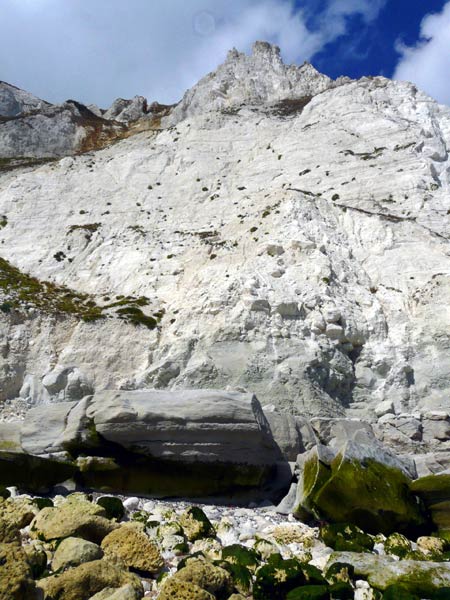
Cliffs up to 150 m high exposing top of Zig Zag Chalk ( at base) overlain by thick Plenus Marl (greyish green) and Holywell and New Pit Chalks (white). Lewes Chalk (greyish) eroded into pinnacles at top of cliffs.
Photograph taken: 10/08/2011
Grid ref TV58879540
Direction NNW
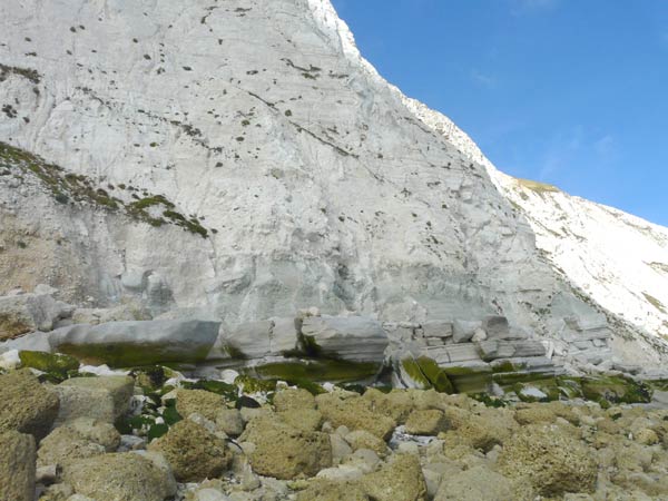
Base of cliff exposing Zig Zag Chalk with interbedded marls overlain by Plenus Marls (greyish green) in turn overlain by white Holywell Nodular Chalk.
Photograph taken: 10/08/2011
Grid ref TV58849539
Direction NNE
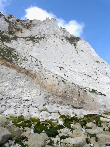
Cliffs up to 150 m high exposing white Holywell Chalk and New Pit Chalk overlain by greyish Lewes Chalk eroded into pinnacles at top. Landslide debris at left.
Photograph taken: 10/08/2011
Grid ref TV58819539
Direction NNE
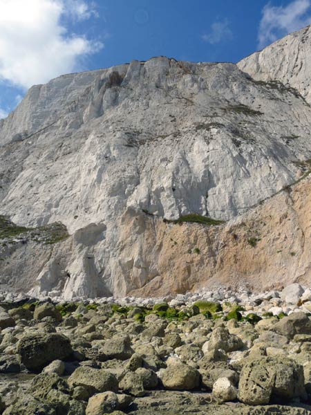
Cliffs up to 140 m high exposing top of Holywell Chalk at base overlain by New Pit and Lewes Chalks with Seaford Chalk at top of cliffs. This is the location of the 2001 landslide which destroyed a natural feature called the Devil's Chimney. Eroded landslip debris obscures base.
Photograph taken: 10/08/2011
Grid ref TV58599530
Direction NW
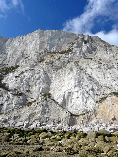
Cliffs up to 140 m high to the west of photo 10 exposing New Pit Chalk in lower cliff overlain by Lewes Chalk and Seaford Chalk at the top of the cliff. Eroded landslide debris obscures the base.
Photograph taken: 10/08/2011
Grid ref TV58499524
Direction NW
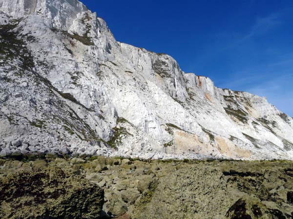
Cliffs and wavecut platform east of the lighthouse exposing Holywell, New Pit and Lewes Chalks with basal Seaford Chalk at the cliff top. At the foot of the cliffs a series of debris fans from landslides have been truncated by wave erosion.
Photograph taken: 10/08/2011
Grid ref TV58429520
Direction NE
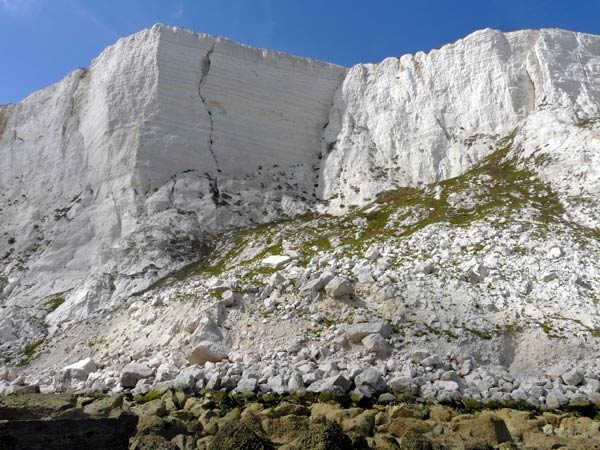
Cliffs up to 140 m high exposing top of Seaford Chalk in the upper cliff underlain by Lewes Chalk. New Pit Chalk is mostly obscured by landslip debris. Cliff faces controlled by vertical joints. Note the prominent fracture in the cliff face.
Grid ref TV58429520
Direction NW
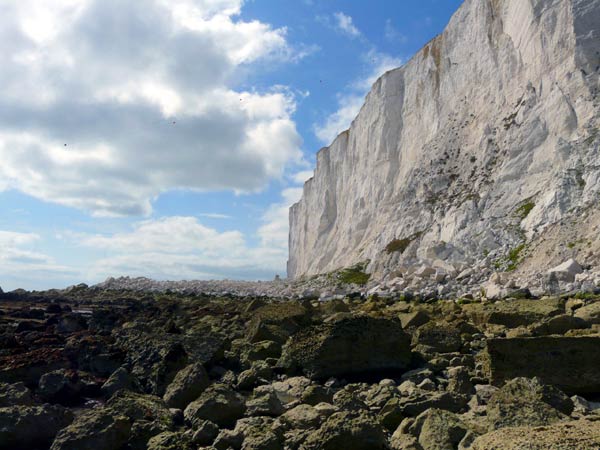
Cliffs west of the lighthouse exposing Lewes Chalk overlain by Seaford Chalk. The upper part of the New Pit Chalk at the cliff base is obscured by landslip debris. Note the tongue of debris from the 1999 landlslide extending across the wavecut platform.
Photograph taken: 10/08/2011
Grid ref TV58429520
Direction west
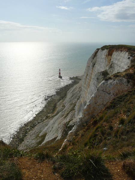
Cliffs east of the lighthouse exposing Seaford Chalk with close-spaced flint bands in the upper cliff underlain by Lewes Chalk. The debris fans at the cliff base obscure the New Pit Chalk.
Photograph taken: 22/09/2011
Grid ref TV58799556
Direction SW